
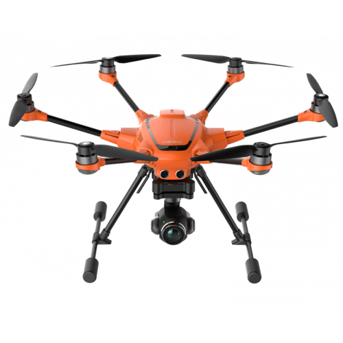

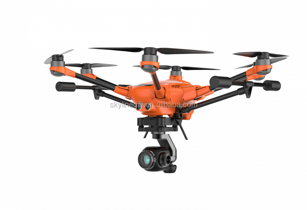
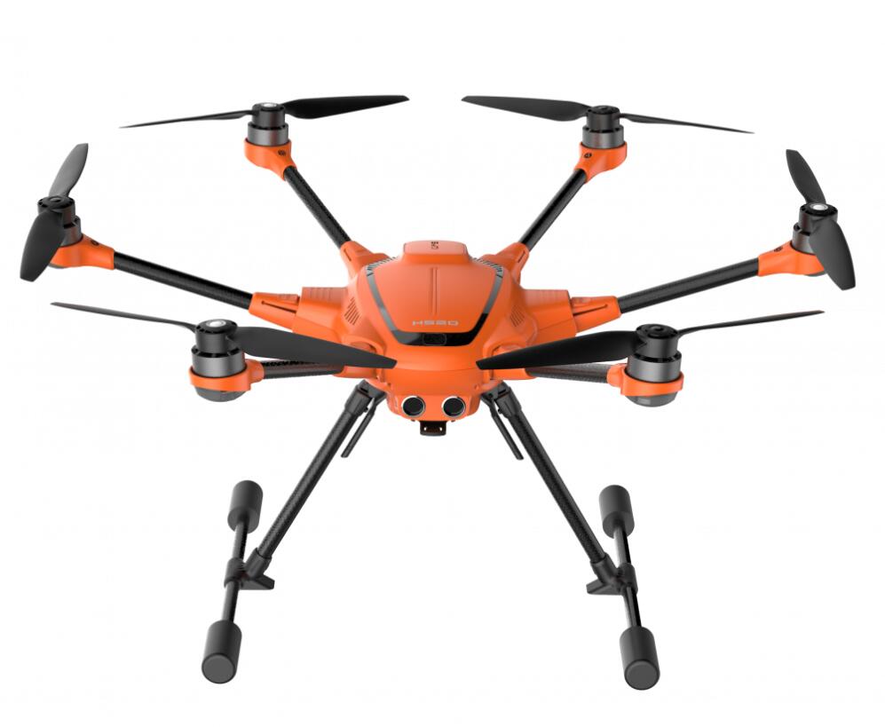
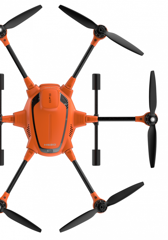
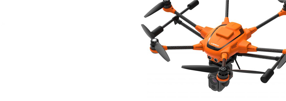
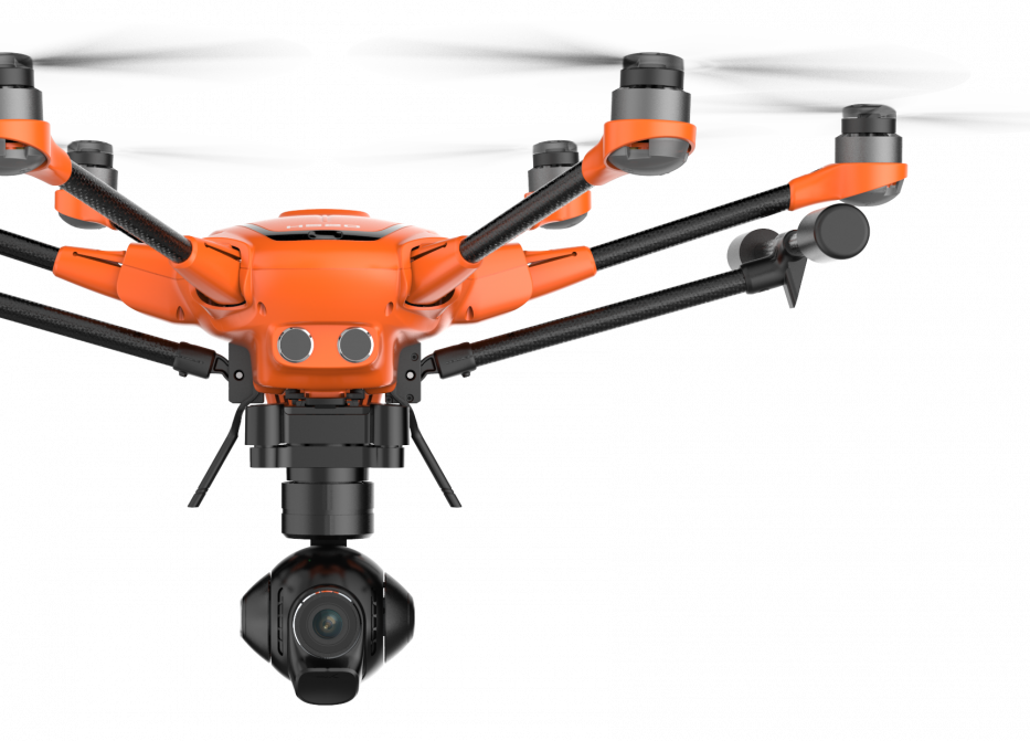
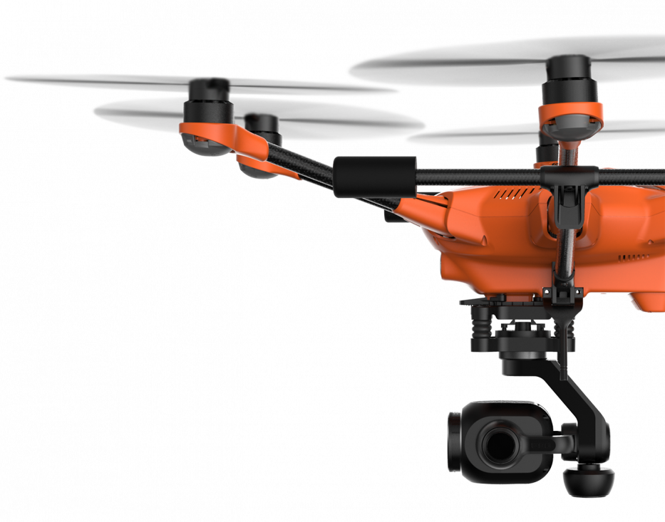
Yuneec Typhoon H520 Hexacopter UAV Photography drone for law enforcement, search and rescue, security etc
- Min. Order:
- 1 set
- Min. Order:
- 1 set
- Port:
- Shenzhen
Your message must be between 20 to 2000 characters
Contact Now| Supply Ability: | 300 Set/Sets per Month Yuneec Typhoon H520 UAV drone |
|---|---|
| Payment Type: | T/T,Western Union,MoneyGram |
| Port: | Shenzhen |
Yuneec Typhoon H520 Hexacopter UAV Photography drone for law enforcement, search and rescue, security etc
Contact me freely if you need this drone and parts
Tel: +86 755 36887751
Cell phone: +86 18665315708
What'sapp: +86 18665315708
Wechat: +86 18665315708
Skype: rita_xian
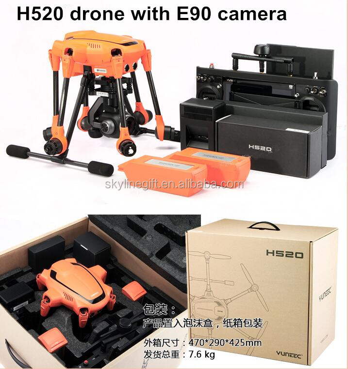
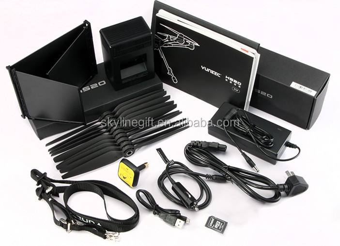
What are inlcuded each drone set?
H520 Hexacopter drone x 1
ST16S Professional Ground Station x 1
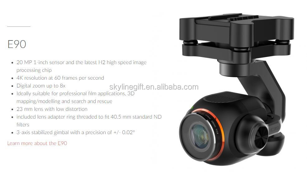
E90 UHD-4K Camera x 1
Propellers x 10
5250mAh Lithium Polymer Battery x 2
SC4000-4H balance charger
Sunshade x 1
Neck-strap x 1
Micro USB Charger x 1
Charger/Adapter x 1
Car Charger x 1
What Applications of Yuneec H520 drone is used?
INSPECTION
- Solar panels
- Wind turbines
- Buildings
- Other vertical assets
SEARCH & RESCUE
- Firefighting
- Rescue services
SECURITY
- Police
- Security
PHOTO & FILM
- Film production
- Wedding photography
- Landscape photography
CONSTRUCTION
- Building Information Modeling
- Site Mapping
Your benefits at a glance
- Designed for professional, commercial and governmental requirements
- 6 rotors for high safety and redundancy as well as high stability and precision even while experiencing wind and turbulence
- Take-off weight with all available camera systems below 2 kg
- Team Mode allows you to independently control copter and camera via two remote control systems
- Reliable position determination by evaluating GPS, Glonass and Galileo satellites
- High-precision, low-interference compass
- Return Home / Return to Controller
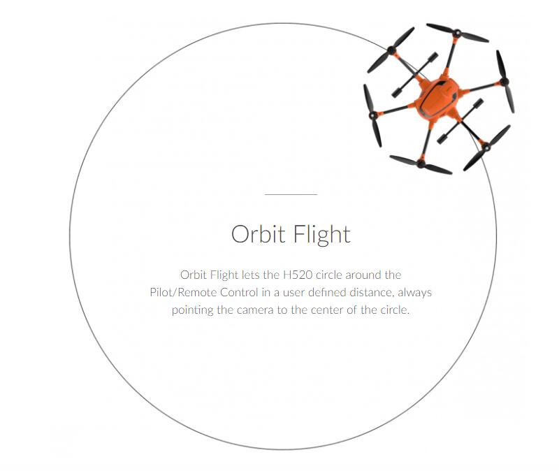
- Orbit Flight
- With terrain follow, the H520 adjusts its flying height in correspondence to the map’s height data
- Good visibility due to bright orange paint
- Video downlink encryption according to the WPA2 standard with a dynamic password
- No data transfer to an external server
- Software is based on solid PX4 code
- Intelligent sonar collision avoidance for safe and stress-free flying
- Energy efficient and quiet with a flight time of up to 28 minutes / 25 minutes with CGOET/E90
- ST16S with an integrated 7” touch display, voice output and multilingual comprehensive DataPilot™ software
- HDMI signal directly from the ST16S to output the drone’s live image onto larger monitors
- Mission planning on the computer or on the ST16S, offline maps available, creation of own maps possible
- Waypoint and survey missions, including cross-wise flights, suitable for construction surveying, perimeter security, accident reconstruction, 3D scans, orthomaps, area inspections and S&R tasks
- 2D/3D mapping
- DataPilot™ automatically generates the flight route when an area to be scanned is specified, including a possible battery change.
- Definition of resolution over inches per pixel or altitude
- Missions can be saved for any repetition of the same flight route (e.g., for tracking shots)
- SDK available: third-party software and adaptation to your own application are possible.
- Lower space requirement and short set-up time
- Retractable landing gear and 360 degree endlessly rotatable camera gimbal for precise alignment or a permanent all-round view, even during tethering
- Hot-swappable camera/gimbal systems
Commercial aerial solution
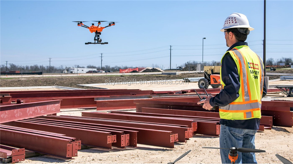
The H520 system utilizes Yuneec’s proven six-rotor platform and incorporates enterprise-grade cameras and mission planning software for high-end commercial use. The sUAS is the perfect solution for long flight times and a proven and robust technology in an all-in-one package. The H520 is built for inspection, law enforcement, security, construction, surveying, and mapping applications in addition to offering cinematic imaging payload systems.
Built for industrial use and ambitious professionals
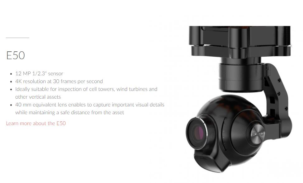
The H520 is designed with the inspection industry in mind with six-rotor systems that allow for stable, precise flight, long focal-length lenses that allow the sUAS to fly at greater distance from an object and data storage that may be shared instantly from the ST16S Ground Station or delivered directly in 4K/2K/HD video or 20Mp still images.
Reliable, stable and precise
Even in high-wind environments, the Yuneec H520 sUAS system is able to hold position, allowing the solution to fly even when a manned inspection would be deemed unsafe. Exclusive flight speed control offers slowest speed above stall flight for maximum precision in challenging environments. H520’s landing gear retracts out of the way to give you a full, 360° view of the world to capture important data in the field. Also Commercial, comprehensive service packages are available separately.
No transfer to remote servers
Your data belongs to you. The H520 Hexacopter and the ST16S remote control communicate directly, so there is no involuntary data transfer to servers in China, Germany or anywhere else in the world. Neither flight data nor images, videos or logfiles are forwarded to external servers and remain in your possession. Thus, your data is optimally protected.
Hot-swap payload options
All of our H520 cameras are hot swap-capable on our sUAS platforms, allowing for significant time-savings through not requiring a power-down/restart of the UAS system. This also allows for consistency of data-storage, rather than using multiple storage devices and locations. Whether it’s thermal imaging, long focal length, or wide focal-length data capture, memory cards may be swapped from device to device.
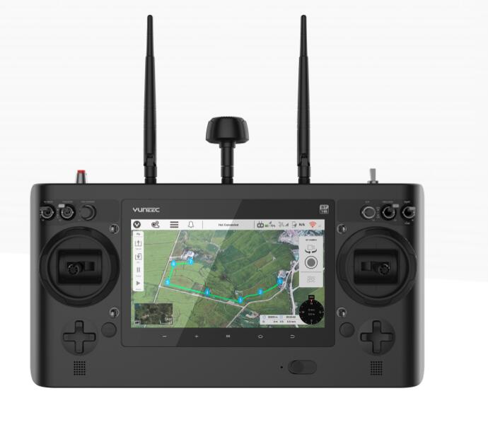
ST16S all-in-one controller
The ST16S Ground Station is an all-inclusive transmitter and receiver that gives you full control over the H520 during flight, allowing users to capture photos and video with great ease. With a large 7-inch integrated screen, the Android-based ST16S controller displays real-time footage of your flight, eliminating the need for an external device. You can also use the ST16S as a mission planner. Plan your flight using the touch screen, and execute your mission with just a single press of a button
YUNEEC DataPilot™
Yuneec DataPilot™ software system enables users to efficiently and consistently create orthomaps, 3D scans, crop data imagery, in the field or on the desktop for repeatable, recallable aerial flight paths, without requiring expensive third party software. Missions/flights may be stored for later recall/reflight, or planned off-site and transported to the control system via email, thumbdrive, or micro-SD card. DataPilot auto-generates survey paths with user-defined frontlap/sidelap, and cross-hatching for precision 3D or large format image output. DataPilot also allows for storage/caching of maps from many map providers for access in areas with no connectivity, and provides tools for precise waypoint placement even in areas where no updated maps are available. DataPilot™ is integrated with the ST16S via 7” Multi-function display, and may be used for exporting flight logs, integrating with popular analytics and post-processing applications such as Pix4D, Agisoft, Datumate, DroneDeploy, Dronifi, and many others.
Team Mode Functionality
Team Mode allows you to independently control copter and camera via two remote control systems. While the drone pilot continues to take control of the copter, the camera operator can concentrate entirely on the camera. This collaboration greatly facilitates the capture of creative images and provides not only film producers, but also fire departments, inspectors and other commercial users with a helpful tool for making jobs more precise and to work in a team.
Download Manual - How to activate the Team Mode functionality
Please note the mentioned safety instructions for using Team Mode with H520.
-
Osmo Action 4 Adventure Combo - 4K/120fps Waterproof Action Camera with a 1/1.3-Inch Sensor 10-bit & D-Log M Color
-
ROBOSEA SEAFLYER Sea Underwater Scooter 45 min 30m Swimming Diving Snorkeling Sports Waterproof Electric Scooter
-
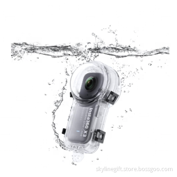
Original Insta360 X3 Invisible Dive Case Sports Action Camera Accessories
-
Sublue Whiteshark Tini Underwater Scooter 45 min Sublue Sea Electric Scooter for Kids


Related Keywords
-
Osmo Action 4 Adventure Combo - 4K/120fps Waterproof Action Camera with a 1/1.3-Inch Sensor 10-bit & D-Log M Color
ROBOSEA SEAFLYER Sea Underwater Scooter 45 min 30m Swimming Diving Snorkeling Sports Waterproof Electric Scooter
Original Insta360 X3 Invisible Dive Case Sports Action Camera Accessories
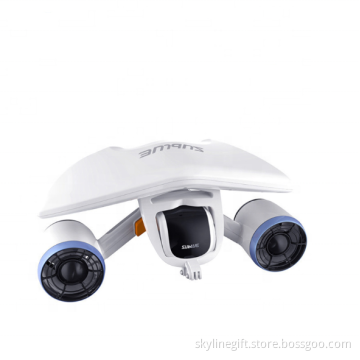
Sublue Whiteshark Tini Underwater Scooter 45 min Sublue Sea Electric Scooter for Kids
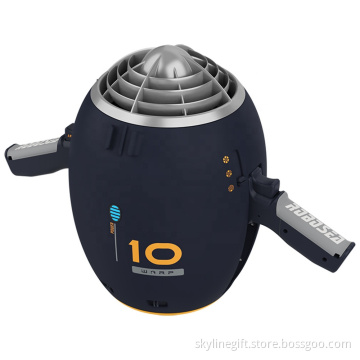
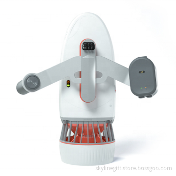
ROBOSEA WARP 10 Sea Underwater Scooter with Camera 65 min 30m Swimming Diving Snorkeling Sports Waterproof Electric Scooter
Related Products-
ROBOSEA SEAFLYER Sea Underwater Scooter 45 min 30m Swimming Diving Snorkeling Sports Waterproof Electric Scooter
-
ROBOSEA WARP 10 Sea Underwater Scooter with Camera 65 min 30m Swimming Diving Snorkeling Sports Waterproof Electric Scooter
-
Sublue Whiteshark Tini Underwater Scooter 45 min Sublue Sea Electric Scooter for Kids
-
Sublue MixPro Underwater Scooter 60 min 40m Sublue Sea Electric Scooter for Kids
-
Sublue Hagul EZ Underwater Scooter 50 min 15m Sublue Sea Electric Scooter Kids Waterproof Detection Diving Propeller


