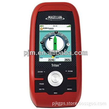

Cheap Handheld GPS Magellan 310 Handheld GPS Survey
- Payment Type:
- T/T
Your message must be between 20 to 2000 characters
Contact Now| Place of Origin: | USA. |
|---|---|
| Payment Type: | T/T |
cheap handheld gps Magellan 310 handheld gps survey
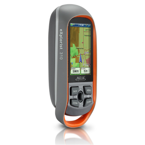
Magellan handheld GPS Navigation eXplorist 310
Affordable price
Complete function
a great variety of models
The Magellan eXplorist 310 GPS receiver comes packed with tons of helpful features and is ready to use right out of the box.
The eXplorist 310 is pre-loaded with the World Edition map, which includes a complete road network in the United States, Canada, Western Europe, and Australia and major roads throughout the rest of the world. This unique preloaded map also includes water features, urban and rural land use, and city centers. Regional versions of Magellan's Summit Series topographic maps are available for download to expand mapping coverage and level of detail.
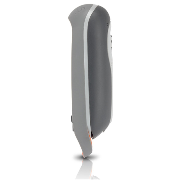
A vibrant, transflective color screen allows for the best readability in direct sunlight. To zero in on the exact location of a geocache, favorite fishing spot, or the next summit, the SiRFstarIII GPS chipset provides accuracy of 10-15 feet (3-5 meters). To keep your outdoor adventure going all day long, the device is powered by two AA batteries for 18 hours of constant usage. The eXplorist 310 is rugged, waterproof, and submersible (IPX-7). All of this is packed into a small and attractive handheld form factor that can be hung around your neck with the optional Magellan lanyard or attached to your pack with the built-in carabineer hook.
The eXplorist 310 provides unmatched assistance with navigation, such as the combination of the world's two most useful navigational tools – a compass and a map! Overlay a series of different transparent compass styles on top of a pre-loaded worldwide map that show roads, water features, parks, and city centers. Access the dashboard screen that shows a mini-compass for quick reference and customizable navigation data fields, such as latitude, longitude, heading, bearing, distance to end, trip odometer, and many more. Go back to the map screen and view your active track, which is a series of digital breadcrumbs to record all yours movements. Mark your starting point (car, trailhead, parking lot…) with a waypoint and easily navigate back to that location at the end of the day.
The eXplorist 310 supports paperless geocaching, which allows you to download more than 20 unique characteristics of each cache, including name, location, description, hider, size, difficulty, terrain, hint, spoilers, attributes, and last 20 user logs among a number of other details.
Reference your track summary to keep track of your distance travelled, elevation gained or lost, complete travel time, moving time and stopped time, and average time to find. Easily reset your track summary statistics to track the details of your next geocaching adventure.
No matter where you enjoy the outdoors, the eXplorist 310 GPS receiver will provide precise GPS signals thanks to the Satellite Based Augmentation Systems (SBAS) of WAAS, EGNOS, and MSAS; display coordinates in a myriad of different global systems, including UTM and WGS84; and accurately guide you to and from your next adventure, where ever in the world that may be!
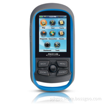
Easy to Navigate Menus and Rich Graphics
A simple main menu, intuitive contextual menus, and vibrant graphics make this device easy to use
Brilliant, sunlight readable color screen
A vibrant 2.2" color transflective screen provides the best readability in direct sunlight
Rugged and waterproof to IPX-7 standards
Focus on the adventure not protecting the device
High-sensitivity SiRFstarIII GPS with 3-5 meter accuracy
3-5 meter GPS accuracy provides a superior navigation experience

Related Keywords