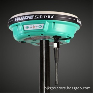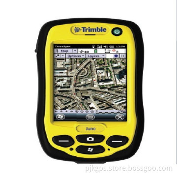
Outdoor Handheld GPS Survey Gnss/GPS System Trimble Gis Xh6000/Xr6000data Collection
- Payment Type:
- T/T, Paypal, Money Gram, Western Union
Your message must be between 20 to 2000 characters
Contact Now| Place of Origin: | USA |
|---|---|
| Payment Type: | T/T, Paypal, Money Gram, Western Union |
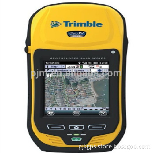
THE ACCURACY YOU NEED ANYWHERE YOU NEED IT
Bringing together the essential functionality for productive GIS data collection in one device, the Trimble® GeoExplorer® 6000 series also delivers positioning accuracy in challenging GNSS situations such as under trees and near buildings with Trimble Floodlight™ technology. Wherever you work, it just works.
Accurate, productive, reliable data collection
Integrating both a GPS/GLONASS receiver and a dual frequency GNSS antenna, the Trimble GeoExplorer 6000 series delivers accuracy you can depend on to record new assets, or reliably navigate back to previously recorded locations.
Used with Trimble's range of powerful field and office software, GeoExplorer 6000 series handhelds allow you to work faster and in more places than ever before. The Trimble GeoExplorer series can deliver down to centimeter accuracy—either postprocessed or in real time for the confidence the job is done right while still on site.

Designed for work, wherever you work
The Trimble GeoExplorer series works for the way you work. The built-in 5 megapixel autofocus camera, with geotagging capability, gives you one of the best ways to capture information about an asset, event,
or site. A sunlight-optimized display maintains exceptional clarity in all outdoor conditions for crisp on screen text and images. And you can stay connected with an optional integrated 3.5G cellular modem for continuous network and Internet access to real-time map data, web-based services,Trimble VRS™ corrections, and live update of field information.
Trees and buildings create "satellite shadows", limiting the areas where you can reliably collect high-accuracy GNSS data.
GNSS
Receiver. . . . . . . . . . . . Trimble Maxwell™ 6 GNSS chipset
Channels . . . . . . . . . . . . . . . . . . . . . . . . . . . . . . .220 channels
Systems . . . . . . . . . . . . . . . . . . . . . . . . . . . . . GPS, GLONASS1 WAAS/EGNOS/MSAS/GAGAN
Update rate . . . . . . . . . . . . . . . . . . . . . . . . . . . . . . . . . . . 1 Hz
Time to first fix. . . . . . . . . . . . . . . . . . . . . . . . . . 45 s (typical)
NMEA-0183 support. . . . . . . . . . . . . . . . . . . . . . . . Optional
Trimble Floodlight technology. . . . . . . . . . . . . . . Optional
RTCM support. . . . . . . . . . . . . . . . . . . . .RTCM2.x/RTCM3.x
CMR support. . . . . . . . . . . . . . . . . . . . . . CMR/CMR+/CMRx
GeoXH handhelds
GPS. . . . . . . . . . . . . . . . . . . . . . . . . . . . . . . . . .L1C/A, L2C, L2E
GLONASS. . . . . . . . . . . . . . . . . . . . . . L1C/A, L1P, L2C/A, L2P
GNSS ACCURACY2
GeoXH Centimeter Edition
Real-time Centimeter output
Horizontal (external antenna3). . . . . . . . . . 1 cm + 1 ppm
Vertical (external antenna). . . . . . . . . . . . 1.5 cm + 2 ppm
Horizontal (internal antenna) . . . . . . . .2.5 cm + 1.2 ppm
Vertical (internal antenna). . . . . . . . . . . . . . 4 cm + 2 ppm
Postprocessed Centimeter output
Horizontal (external antenna3). . . . . . . . . . 1 cm + 1 ppm
Vertical (external antenna). . . . . . . . . . . . 1.5 cm + 1 ppm
Horizontal (internal antenna) . . . . . . . .2.5 cm + 1.2 ppm
Vertical (internal antenna). . . . . . . . . . . . 4 cm + 1.5 ppm
All GeoXH configurations
Real-time and postprocessed H-Star (Horizontal RMS)
H-Star. . . . . . . . . . . . . . . . . . . . . . . . . . . . . . . .10 cm + 1 ppm
All GeoXH and GeoXT configurations
Real-time DGNSS (Horizontal RMS)
Code. . . . . . . . . . . . . . . . . . . . . . . . . . . . . . . . .75 cm + 1 ppm
SBAS4 (WAAS/EGNOS/MSAS). . . . . . . . . . . typically < 1 m
Postprocessed DGNSS (Horizontal RMS)
Code. . . . . . . . . . . . . . . . . . . . . . . . . . . . . . . . .50 cm + 1 ppm
Carrier (after 45 minutes). . . . . . . . . . . . . . . 1 cm + 2 ppm

Related Keywords