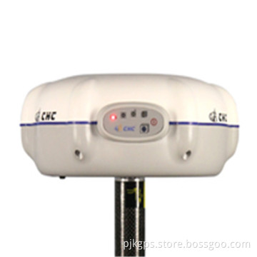

2014 Promotion Selling Leica Chc X900 Plus Gnss Rtk GPS
- Payment Type:
- L/C, T/T, Western Union, Paypal, Money Gram
Your message must be between 20 to 2000 characters
Contact Now| Place of Origin: | China |
|---|---|
| Payment Type: | L/C, T/T, Western Union, Paypal, Money Gram |
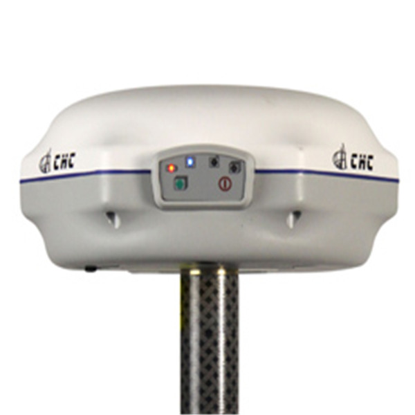
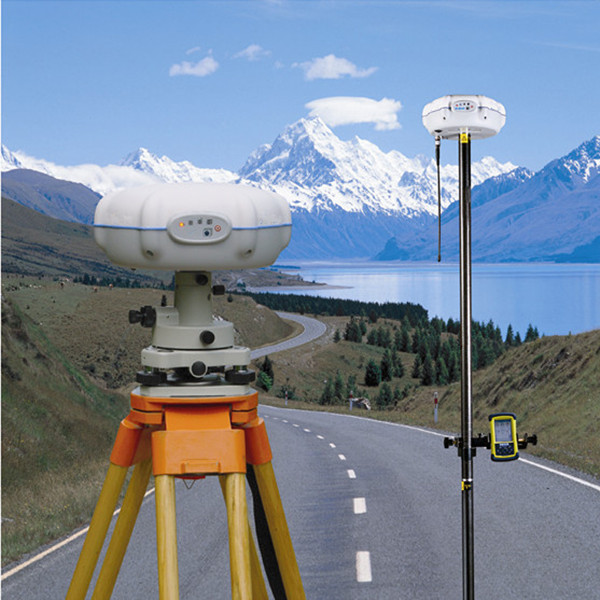
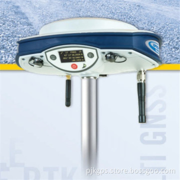
International Selling leica CHC X900 gnss rtk system
The CHC X900 GNSS is a compact GNSS receiver designed for high accuracy and productivity - even in harsh environments. Powered by 120 channels GNSS core engine, the X91 GNSS provides a costeffective solution to any surveying project.
Easy-to-use, efficient and intuitive work flow, designed for advanced network RTK survey, compact and rugged, the X91 is the perfect choice for demanding survey applications.
Fully Integrated
Built-in GNSS engine, antenna, UHF and GSM/GPRS modules, Bluetooth® communication in one single unit to make your everyday work simple.
Compact and lightweight
The size of 180 mm x 80 mm (3.1 x 7.1 in) makes the X91 only weights 1.35 kg (48 oz) with battery.
Optimized for Network RTK Connection to GPS or GPS+GLONASS RTK Networks is made easy
and benefits from the unique X91 auto-connect feature.
Compatibility
The X900 RTCM compliance with major GPS brands allow a trouble-free integration into an existing pool of survey instrument.
Competitive and Reliable
By combining decades of positioning and surveying know-how, the X91 GNSS is one of the most powerful GNSS RTK solutions, with no compromise with quality but at an affordable price for every surveyor.

GNSS characteristics(1)
· 120 channels with simultaneously tracked satellite signals
- GPS: L1C/A, L2E, L5
- GLONASS: L1C/A,L1P, L2C/A, L2P
- SBAS:WAAS, EGNOS, MSAS
-Beidou:B1,B2
- Galileo: GIOVE-A and GIOVE-B (test)
· Advanced multipath mitigation technology
· Low noise carrier phase measurement
Performance specifications
· Real Time Kinematics (RTK)
- Horizontal: 10 mm + 1 ppm RMS
- Vertical: 20 mm + 1 ppm RMS
- Initialization time: typically < 10 s
- Initialization reliability: > 99.9%
· Post Processing Static
- Horizontal: 2.5mm + 1ppm RMS
- Vertical: 5mm + 1ppm RMS
- Baseline Length: ≤ 300 km
Communications
· 1x RS232 serial port
· 1x high speed USB
· Integrated GSM/GPRS modem
· Integrated Bluetooth® class 2
· Optional radio modem:
- Internal Rx: 410-430 / 430-450 / 450-470 MHz
- External Tx DL5: 1W - 20W adjustable (3)
· Protocols:
- RTCM2.1, RTCM2.3, RTCM3.0, CMR, CMR+ input and
output
- NMEA0183 output
- RINEX and HCN outputs for GNSS raw data
Physical
· Size (HxD): 80 x 180 mm (3.1 x 7.1 in)
· Weight: 1.35 kg with battery (48 oz)
· Operating temperature: -30 °C to +65 °C (-22°F to 149°F)
· Storage temperature: -40 °C to +75°C (-40°F to 167°F)
· Humidity: 100% condensation
· Waterproof and dust proof: IP67 - protected from temporary immersion to depth of 1 meter, floats
· Shock: survives a 2-meters drop on to concrete
Electrical
· Power consumption: 2.6 W
· Li-ion battery capacity: 2200 mAh
· Battery life: typical 5 hours in RTK mode
· External power input: 9-18 VDC
Software (optional)
· CHC's Landstar field data collection software
· Carlson's SurvCE field data collection software
Related Keywords